
Show summary Hide summary
- Somerset flooding: from wet winter to recurring crisis
- Inside the emergency response on the Somerset Levels
- Bridgwater Tidal Barrier and new flood defense infrastructure
- Human stories, environmental impact and paths to resilience
- What can strengthen Somerset’s climate resilience now
- Why does Somerset flood so often compared with other regions?
- Will the Bridgwater Tidal Barrier stop future floods completely?
- How is climate change linked to the recent Somerset storms?
- What can homeowners on the Somerset Levels do to reduce damage?
- Are nature-based solutions really effective against flooding?
Water racing past garden walls at nearly eight metres on the gauge isn’t just a number. It is the moment people in Somerset decide whether to move furniture upstairs or leave everything behind.
Over the past decade, flooding on the Somerset Levels has shifted from rare disaster to recurring threat. Intense rainstorms, higher river levels and repeated tidal surge events now converge on communities that have lived with water for centuries, tipping coexistence into confrontation.
Somerset flooding: from wet winter to recurring crisis
Somerset’s history has always been written in water. Medieval drainage turned marsh into farmland, yet the winter of 2013–14 showed how quickly that balance can fail. More than 600 homes and around 17,000 acres of farmland were inundated, with some villages cut off for weeks, as detailed in reports on families finally returning one year on.
How to Create a DIY Worm Farm That Can Compost Food Scraps, Paper, and Even a Whole Kangaroo
How Squid Triumphed Over Earth’s Greatest Extinction to Dominate the Oceans
A decade later, the pattern is disturbingly familiar. In late January, three storms in quick succession – Goretti, Ingrid and Chandra – drove the Parrett and Tone rivers to new peaks. At a monitoring point near Northmoor pumping station, the water reached 7.76 metres. Flooding of homes usually begins above 6.6 metres, leaving villages such as Moorland and Fordgate anxiously watching every centimetre.
Why climate change is intensifying Somerset’s water risk
Scientists from the UK Met Office and the Environment Agency link these events to a warmer atmosphere. Warmer air holds more moisture, so when storms form over the Atlantic they can release heavier downpours over south‑west England. According to local data, the Parrett–Tone catchment recently received around 207% of the long‑term average January rainfall.
Similar patterns appear worldwide. The IPCC reports that heavy rainfall events have become more intense across many mid‑latitude regions, and research shows that global regions are heating at unprecedented rates. For low‑lying areas like the Somerset Levels, this means rivers already swollen by rain meet high tides in the Bristol Channel, creating a stacked risk of river Flooding and tidal surge squeezing the same narrow channels.
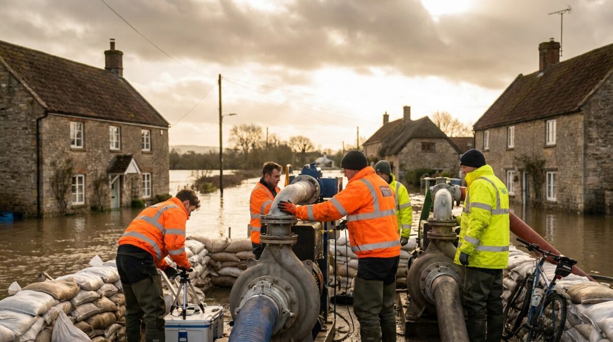
Inside the emergency response on the Somerset Levels
As Storm Chandra drenched the county, six giant temporary pumps were craned into place at Northmoor, backing up the permanent station. Together, they hurled an estimated six tonnes of water every second off the saturated moors into the River Parrett. The scale underlines the engineering race against rising water that now defines Somerset’s Flood Defense strategy.
In Moorland’s village hall, transformed into an informal command hub, Environment Agency staff, police and residents traded updates and comfort. Some households packed bags, moving valuables upstairs in case evacuation orders arrived. Others monitored online river gauges obsessively, until the anxiety became too much to bear.
Communities between gratitude and frustration
Local people repeatedly praise individual pump operators and field officers. Many say those staff have become familiar faces in the dark at 3am when alarms sound. Yet that respect coexists with frustration directed at national decision‑makers. Campaigners in the Flooding on the Levels Action Group argue that emergency pumps should be deployed sooner and that Northmoor pumping station needs permanent upgrading.
Similar tensions appear in other climate‑stressed regions, from coastal megacities dealing with severe water stress to mountain valleys facing rapid snowmelt. Somerset’s story shows how Emergency Response alone cannot keep pace with a shifting climate unless long‑term investment and local insight are woven into planning.
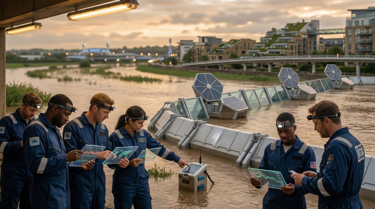
Bridgwater Tidal Barrier and new flood defense infrastructure
Out of the wreckage of 2014 came a 20‑year action plan for Somerset. A centrepiece is the Bridgwater Tidal Barrier, a £249 million scheme on the River Parrett now approved by government. Designed to manage both river flows and tidal surge, it will work alongside raised riverbanks, improved drainage and upgraded roads to protect thousands of homes and businesses around Bridgwater.
The barrier, described in project briefings such as the £249m Bridgwater tidal barrier overview, is more than a wall against water. It is also a piece of Infrastructure intended to unlock regeneration, with a new footbridge reconnecting communities and cycling routes. The design reflects a shift from pure defence to long‑term Water Management and place‑making.
Dredging, pumps and the limits of engineering
Dredging has returned to the Parrett after years of contention. Local authorities report that clearing silt has already reduced the frequency and extent of some floods. On recent storm days, a small Dutch dredger could be seen working steadily up and down the river while temporary pumps roared nearby, a visible symbol of layered defences.
Yet engineers and hydrologists caution that dredging alone cannot offset Climate Change. As sea levels continue to rise and extreme rainfall becomes more frequent, every extra centimetre of channel capacity may buy only limited time. Long‑term resilience will depend on combining grey Infrastructure with restored wetlands that can safely store and release water across the wider catchment.
Human stories, environmental impact and paths to resilience
Behind each statistic sits a household like the Notaro family on the edge of Moorland, building an earth bund around their home for the second time in a decade. Floods do not only damage walls; they erode mental health, fragment communities and strain local services. Residents speak of sleepless nights, insurance battles and the sense of being “left alone” as described in coverage of villages feeling stranded to fight flooding.
The Environmental Impact extends beyond homes. Prolonged inundation damages soils, disrupts ground‑nesting birds and releases stored carbon from peat, quietly feeding the same Climate Change that fuels future extremes. At the same time, when floodwater spreads across fields and wetlands rather than into streets, it can recharge aquifers and support biodiversity – if space is planned for it to go.
What can strengthen Somerset’s climate resilience now
Experts from the Environment Agency, Somerset Rivers Authority and local universities point to a layered approach. No single measure will “solve” Flooding. Instead, the county is gradually building a mosaic of defences, planning tools and community projects aimed at living with water more safely.
Key strands already emerging include:
- Targeted engineering: tidal barriers, raised road levels, upgraded pumping stations and modern telemetry to track river levels in real time.
- Nature‑based solutions: restoring floodplains, re‑wetting peat, planting trees along headwaters to slow runoff and store carbon.
- Adapted homes and farms: raised electrical sockets, flood‑resilient materials, sacrificial ground floors and water‑tolerant crops on the lowest fields.
- Community preparedness: local flood wardens, text alert systems, neighbourhood evacuation plans and mental health support after events.
- Smarter planning: steering new development away from the highest‑risk zones and designing Infrastructure with future climate projections in mind.
For individuals across the Levels, practical steps matter. Checking property risk maps, signing up for warning services, creating grab‑bags and documenting belongings can all reduce losses. On a wider scale, supporting policies that cut greenhouse gas emissions and strengthen resilient Energy and Water Management systems, as explored in research on boosting infrastructure resiliency and restoration, helps tackle the root drivers shaping Somerset’s future floods.
Why does Somerset flood so often compared with other regions?
Much of Somerset’s Levels sit only a few metres above sea level, on former wetlands criss‑crossed by rivers and drainage channels. When intense Atlantic storms meet high tides in the Bristol Channel, water has limited space to go. Climate change is increasing heavy rainfall events, so existing defences and channels are now tested more frequently and more severely than when they were built.
Will the Bridgwater Tidal Barrier stop future floods completely?
The Bridgwater Tidal Barrier is designed to significantly reduce the risk of tidal and fluvial flooding for thousands of properties around the town. However, no barrier can eliminate risk entirely. Extreme events beyond design assumptions, localised surface water flooding and drainage failures can still cause problems, so it is one important layer in a wider flood risk management strategy rather than a total solution.
How is climate change linked to the recent Somerset storms?
Warmer global temperatures increase the water‑holding capacity of the atmosphere. This allows storm systems forming over the Atlantic to carry and release more moisture over the UK. Observations from the Met Office show that intense rainfall events are becoming more frequent, and in the Parrett–Tone catchment recent January totals have exceeded 200% of long‑term averages, amplifying river and surface water flooding.
What can homeowners on the Somerset Levels do to reduce damage?
Jungle Wildlife Shares a Common Tree as Their Preferred Latrine Spot
How Beavers Transform Rivers into Potent Carbon Capture Ecosystems
Homeowners can install flood doors, non‑return valves on drains, and raise electrical sockets and appliances above previous high‑water marks. Using tile or concrete floors instead of carpets on ground levels, preparing an evacuation plan, and signing up to Environment Agency alerts also help. Community‑level actions, such as coordinated sandbag distribution and shared storage of pumps, further reduce impacts when waters rise.
Are nature-based solutions really effective against flooding?
Studies across the UK and Europe indicate that restoring floodplains, wetlands and upstream woodlands can reduce peak flows, delay flood peaks and enhance biodiversity. These measures cannot replace hard infrastructure in high‑risk locations, but they complement it by creating more space for water and storing it safely. In Somerset, re‑wetting peat and reconnecting rivers to designated washlands are increasingly part of official flood risk planning.